Log in
All resources
Create a design
1,414 Free Artworks of Kingdom Of France
bibliothèque nationale de france
chorographia britanniae (1741-1742)
john rocque
remigius parr
john rocque's 1748 map of london and adjacent country
mappa geographica novissima regni hungariae, - divisi in suos comitatus cum districtibus jazygum et cumanorum banatus temesiensis ejusque districtuum nec non regnorum croatiae sclavoniae dalmatiae magni... - btv1b532332906
tranquillo mollo
oil on canvas
maps by willem and johannes blaeu
james gillray
chorographia britanniae (1741-1742)
18th-century maps of kent
17th-century maps of dorset
maps by john speed
18th-century portrait paintings in the rhode island school of design - museum of art
portrait paintings by henri-pierre danloux
paintings in the russell-cotes art gallery and museum
volcano school
17th-century maps of the isle of man
maps by willem and johannes blaeu
arnold van langren map of southwest africa
renaissance
maps of cambridge by braun & hogenberg
bibliothèque nationale de france
paintings by jean-baptiste-camille corot in the national gallery, london
realism,barbizon school
the book of ser marco polo the venetian concerning the kingdoms and marvels of the east (1903)
historical images of canal grande (venice)
portrait paintings of maria antonia of naples and sicily
nicolas-françois dun
chorographia britanniae (1741-1742)
18th-century maps of westmorland
chorographia britanniae (1741-1742)
18th-century maps of monmouthshire
1630s maps of ethiopia
1635 maps of africa
chorographia britanniae (1741-1742)
18th-century maps of northumberland
18th-century maps of huntingdonshire
chorographia britanniae (1741-1742)
18th-century maps of nottinghamshire
chorographia britanniae (1741-1742)
chorographia britanniae (1741-1742)
18th-century maps of cambridgeshire
chorographia britanniae (1741-1742)
18th-century maps of middlesex
chorographia britanniae (1741-1742)
18th-century maps of cumberland
the book of ser marco polo the venetian concerning the kingdoms and marvels of the east (1903)
paintings by domenico tintoretto in doge's palace
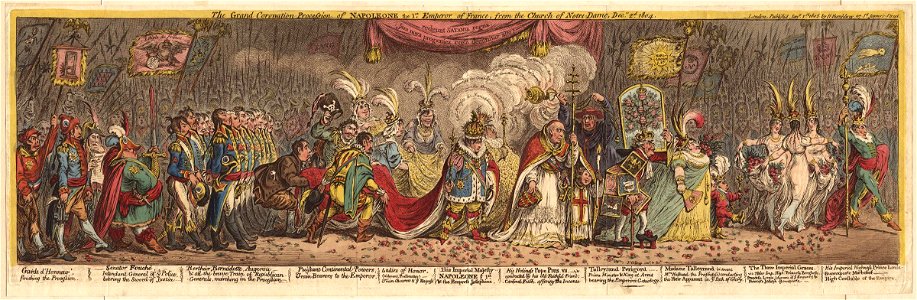
caricatures of napoleon i of france by james gillray
napoleonic wars in art
carte des régences d'alger by hérisson
bibliothèque nationale de france
john rocque's 1748 map of london and adjacent country
remigius parr
carte des régences d'alger by hérisson
bibliothèque nationale de france
male portrait paintings in national trust places
male portrait paintings by alexis simon belle
japanese prints in the metropolitan museum of art
yokohama-e by utagawa sadahide
mappa geographica novissima regni hungariae, - divisi in suos comitatus cum districtibus jazygum et cumanorum banatus temesiensis ejusque districtuum nec non regnorum croatiae sclavoniae dalmatiae magni... - btv1b532332906
tranquillo mollo
mappa geographica novissima regni hungariae, - divisi in suos comitatus cum districtibus jazygum et cumanorum banatus temesiensis ejusque districtuum nec non regnorum croatiae sclavoniae dalmatiae magni... - btv1b532332906
tranquillo mollo
mappa geographica novissima regni hungariae, - divisi in suos comitatus cum districtibus jazygum et cumanorum banatus temesiensis ejusque districtuum nec non regnorum croatiae sclavoniae dalmatiae magni... - btv1b532332906
tranquillo mollo
mappa geographica novissima regni hungariae, - divisi in suos comitatus cum districtibus jazygum et cumanorum banatus temesiensis ejusque districtuum nec non regnorum croatiae sclavoniae dalmatiae magni... - btv1b532332906
tranquillo mollo
mappa geographica novissima regni hungariae, - divisi in suos comitatus cum districtibus jazygum et cumanorum banatus temesiensis ejusque districtuum nec non regnorum croatiae sclavoniae dalmatiae magni... - btv1b532332906
tranquillo mollo
mappa geographica novissima regni hungariae, - divisi in suos comitatus cum districtibus jazygum et cumanorum banatus temesiensis ejusque districtuum nec non regnorum croatiae sclavoniae dalmatiae magni... - btv1b532332906
tranquillo mollo
mappa geographica novissima regni hungariae, - divisi in suos comitatus cum districtibus jazygum et cumanorum banatus temesiensis ejusque districtuum nec non regnorum croatiae sclavoniae dalmatiae magni... - btv1b532332906
tranquillo mollo
mappa geographica novissima regni hungariae, - divisi in suos comitatus cum districtibus jazygum et cumanorum banatus temesiensis ejusque districtuum nec non regnorum croatiae sclavoniae dalmatiae magni... - btv1b532332906
tranquillo mollo
mappa geographica novissima regni hungariae, - divisi in suos comitatus cum districtibus jazygum et cumanorum banatus temesiensis ejusque districtuum nec non regnorum croatiae sclavoniae dalmatiae magni... - btv1b532332906
tranquillo mollo
mappa geographica novissima regni hungariae, - divisi in suos comitatus cum districtibus jazygum et cumanorum banatus temesiensis ejusque districtuum nec non regnorum croatiae sclavoniae dalmatiae magni... - btv1b532332906
tranquillo mollo
mappa geographica novissima regni hungariae, - divisi in suos comitatus cum districtibus jazygum et cumanorum banatus temesiensis ejusque districtuum nec non regnorum croatiae sclavoniae dalmatiae magni... - btv1b532332906
tranquillo mollo
maps by willem and johannes blaeu
old maps of westmorland
18th-century maps of kent
maps by thomas kitchin
bibliothèque nationale de france
maps of wales by humphrey llwyd
paphlagonia heroicis temporibus henetorum populorum sede clara, cujus paphlagonia maritima suit romanorum aetate ponti regni pars occidentalior. in qua sinope totius mithridatis regni caput - ex conatibus... - btv1b53179304p
guillaume sanson
maps by willem and johannes blaeu
1640 maps of africa
cartouche (cartography)
maps by john rocque
château de chanteloup (indre-et-loire)
henri de favanne
works after jean duplessis-bertaux
jean duplessis-bertaux
paintings by circle or workshop of justus van egmont
portrait paintings of louis, grand condé
paintings by eugène boudin
impressionism
chorographia britanniae (1741-1742)
18th-century maps of hampshire
chorographia britanniae (1741-1742)
18th-century maps of rutland
chorographia britanniae (1741-1742)
18th-century maps of suffolk
chorographia britanniae (1741-1742)
18th-century maps of staffordshire
maps by thomas kitchin
old maps of scotland
chorographia britanniae (1741-1742)
18th-century maps of lincolnshire
17th-century maps of carmarthenshire
17th-century maps of pembrokeshire
18th-century maps of norfolk, england
chorographia britanniae (1741-1742)
18th-century maps of herefordshire
old county maps of herefordshire
chorographia britanniae (1741-1742)
18th-century maps of dorset
chorographia britanniae (1741-1742)
18th-century maps of hertfordshire
chorographia britanniae (1741-1742)
18th-century maps of warwickshire
chorographia britanniae (1741-1742)
18th-century maps of worcestershire
chorographia britanniae (1741-1742)
old county maps of county durham
18th-century maps of northamptonshire
chorographia britanniae (1741-1742)
18th-century maps of gloucestershire
chorographia britanniae (1741-1742)
chorographia britanniae (1741-1742)
18th-century maps of cheshire
18th-century maps of buckinghamshire
chorographia britanniae (1741-1742)
chorographia britanniae (1741-1742)
18th-century maps of berkshire
chorographia britanniae (1741-1742)
18th-century maps of somerset
old maps of whole wales (alone)
1670s maps of wales
chorographia britanniae (1741-1742)
18th-century maps of surrey
chorographia britanniae (1741-1742)
18th-century maps of shropshire
chorographia britanniae (1741-1742)
18th-century maps of leicestershire
chorographia britanniae (1741-1742)
18th-century maps of bedfordshire
chorographia britanniae (1741-1742)
18th-century maps of devon
chorographia britanniae (1741-1742)
18th-century maps of derbyshire
prints in the royal collection of the united kingdom
robert dodd
old maps of plymouth and devonport
16th-century maps of england
oil paintings of the royal museums greenwich
dominic serres
landscape paintings by eugène delacroix
romanticism
drouais, after - marie joséphine of savoy as diana - hartwell house
paintings in hartwell house, buckinghamshire
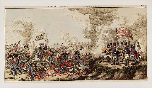
historical images of soldiers
romanticism
political cartoons by james gillray
caricatures of the united kingdom
george villiers, 4th earl of jersey
george, prince of wales in 1796
john rocque's 1748 map of london and adjacent country
remigius parr
john rocque's 1748 map of london and adjacent country
remigius parr
john rocque's 1748 map of london and adjacent country
remigius parr
john rocque's 1748 map of london and adjacent country
remigius parr
john rocque's 1748 map of london and adjacent country
remigius parr
john rocque's 1748 map of london and adjacent country
remigius parr
john rocque's 1748 map of london and adjacent country
remigius parr
john rocque's 1746 map of london
remigius parr
bibliothèque nationale de france
maps of wales by humphrey llwyd
john rocque's 1746 map of london
remigius parr
john rocque's 1748 map of london and adjacent country
remigius parr
john rocque's 1748 map of london and adjacent country
remigius parr
views of nonsuch palace by joris hoefnagel
bibliothèque nationale de france
john rocque's 1748 map of london and adjacent country
remigius parr
john rocque's 1748 map of london and adjacent country
remigius parr
john rocque's 1746 map of london
remigius parr
bibliothèque nationale de france
maps by john rocque
john rocque's 1748 map of london and adjacent country
remigius parr
1101 - 1200 of 1,414
Next page
/ 15